Accurate traffic forecasting must take into account the feedback effects of spare capacity (to increase demand) and congestion (to reduce demand), as well as the broader land-use implications of roadway design.
By Ryan McGreal
Published June 21, 2012
A common theme quickly emerged in the objections to the recent new vision for Main Street West with one lane in each direction, curbside parking and dedicated bike lanes: among detractors both civil and snarky, the big fear is that we'll have 'gridlock' and 'traffic chaos' if we significantly reduce lane capacity on Main.
After all, if the same number of cars are trying to drive on fewer lanes, it seems reasonable to predict that those lanes will become congested.
However, the assumption that the number of cars will remain the same turns out to be false. When we look at what happens when cities actually reduce lane capacity, a significant share of traffic simply "disappears".

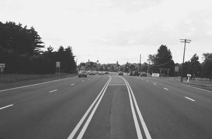
A reimagined Main Street with one traffic lane in each direction
In economics, induced demand is the general principle that when the supply of a product increases, demand for it will also increase.
It should not come as a surprise that this principle also applies to the supply of automobile lane capacity. Decades of research have demonstrated that demand for traffic lanes tends to increase to fill the available supply.
Todd Litman, a transportation planner based in Victoria, BC, explains the elastic nature of traffic in a 2011 report [PDF link] titled "Generated Traffic and Induced Travel: Implications for Transport Planning":
Traffic congestion tends to maintain equilibrium. Congestion reaches a point at which it constrains further growth in peak-period trips. If road capacity increases, the number of peak-period trips also increases until congestion again limits further traffic growth. The additional travel is called "generated traffic." Generated traffic consists of diverted traffic (trips shifted in time, route and destination), and induced vehicle travel (shifts from other modes, longer trips and new vehicle trips). Research indicates that generated traffic often fills a significant portion of capacity added to congested urban road.
In short, generated traffic is the portion of total traffic that only exists because it is easier to drive. Litman goes on to note that planners need to take generated traffic into consideration when evaluating the benefits of expanded lane capacity:
Generated traffic has three implications for transport planning. First, it reduces the congestion reduction benefits of road capacity expansion. Second, it increases many external costs. Third, it provides relatively small user benefits because it consists of vehicle travel that consumers are most willing to forego when their costs increase.
When planners ignore the phenomenon of generated traffic and expand road capacity on the prediction that demand will increase, the expanded road capacity itself generates the additional demand that fills the expanded capacity. Litman calls this "self-fulfilling predict and provide planning".
It's essential to understand that the law of demand on traffic works in reverse as well: if you reduce lane capacity, some of the generated traffic simply disappears.
A major study commissioned by London Transport and the British Department of the Environment, Transport and the Regions was published in 1998 and analyzed the evidence from 60 cities in North America and Europe that had reduced lane capacity. Here's an excerpt from a summary of the study [RTF link] by its authors, titled "Evidence on the Effects of Road Capacity Reduction on Traffic Levels":
Many cities, either not provided with dissuasive modelling forecasts, or disbelieving them, have introduced measures to reallocate road space away from cars.
In general, they reported that there has often (but not always) been a fairly short period of traffic disruption, but that 'gridlock' or 'traffic chaos' are rare, and never last longer than a few days, as traffic adjusts relatively quickly to new conditions. Sometimes there has not even been a short-term problem.
Two characteristic comments from local transport planners are: 'it'll be all right by Friday', and the ubiquitous 'the traffic has disappeared and we simply don't know where it has gone to'.
The authors note that the biggest real reductions in overall traffic occur when:
This, of course, is entirely consistent with what happened when Hamilton converted James and John Streets to two-way. There was no disruption at all following the conversion of James and John North, and only a temporary disruption for a few days following the conversion of James and John South.
This is despite the widespread predictions of doom that flowed from the common, but false, assumption that total traffic volumes would not decrease.
Induced demand and generated traffic are well-established principles of transportation networks. Unfortunately, the standard tools for modelling traffic are generally based on the assumption that traffic flows will remain constant if lane capacity is changed.
As a result, traffic models tend to produce erroneous predictions. A 2006 study of traffic forecasts [PDF link] by the Department of Development and Planning at Aalborg University, Denmark concluded:
If techniques and skills for arriving at accurate demand forecasts have improved over time, as often claimed by forecasters, this does not show in the data. ... For 50% of road projects, the difference between actual and forecasted traffic is more than ±20%; for 25% of road projects, the difference is larger than +/-40%.
A major source of error is that traffic modelling generally does not account for the network effects of induced and reduced demand, in which transportation choices are shaped in part by the availability of lane capacity.
A 2001 study [PDF link] of generated traffic and implications for traffic planning using EMME, the industry standard modelling software, found:
In recent years, there has been a wealth of theoretical and empirical evidence collected on generated traffic and its impacts. As a result, there is an emerging consensus among transport professionals that generated traffic and induced travel are real phenomena that must be considered for accurate transport forecasts and economic analysis.
The authors explain, "Traditional transport models assume traffic volumes must flow through the transport network like water through pipes. But in many urban situations, traffic flows are more like a gas - they expand or retract to fill the available space."
Like most engineering models, these transport models work well for small changes to the current situation, but fail for large changes like two-way conversion of a one-way street. Accurate forecasting must take into account the feedback effects of spare capacity (to increase demand) and congestion (to reduce demand), as well as the broader land-use implications of roadway design. But as the authors note:
[M]ost transport models treat land-use development patterns as an exogenous impact unaffected by transport decisions. Models without full feedback give inaccurate predictions of traffic congestion and travel speeds, and so cannot accurately evaluate transport policies and projects.
According to Kelly Anderson, spokesperson for the Public Works Department, the City of Hamilton uses EMME (version 2) for traffic modelling at a macro level, as well as Synchro and SimTraffic (version 7) for micro-level traffic signal modeling.
These tools allow planners to plot traffic lanes and intersections, enter volumes of traffic and generate models of how the traffic will flow through the network. Steve Molloy, manager of environment and sustainable infrastructure in the City's Public Works department, notes that EMME and Synchro/SimTraffic "have been primarily used as 'industry standard' over the past several years."
However, these tools were not designed to model the feedback effects of significant changes to street design. They can only model how a given volume of traffic will move through a given traffic network.
The City does not have a specific policy on traffic growth assumptions, but planners "typically take into account existing traffic volumes, historical traffic growth, projected traffic based on nearby developments, as well a specific development itself" when modelling changes to the traffic network.
Planners can manually change the assumed volume of traffic. Molloy points out that the Transportation Master Plan provides "overall direction on how we want the transportation network to operate.
How these programs typically operate is that different scenarios are identified and then "modeled" to identify potential outcomes along the transportation network (i.e. traffic reduction assumptions associated with other modes based on targets and traffic diversion, which makes assumptions on travel patterns associated with adjustments to the road network (road widening/new roads)).
He adds that the city works with consultants "as the experts to provide us with the support using good planning and engineering judgement and up-to-date best practice approaches."
For example, the forecasting conducted by Steer Davies Gleave for the City's B-Line LRT planning assumed a 20 percent decrease in automobile traffic due to a modal switch to LRT, based on the city's Transportation Master Plan target.
I hope this is a sign that the City's baseline assumption about traffic volumes is changing. As recently as 2009, the default approach was to assume that traffic volumes would remain constant or actually increase.
Hart Solomon, the City of Hamilton's former head of traffic engineering (now retired), defended his decision to reject a pedestrian scramble from the York Boulevard Redevelopment plan on the grounds that it would be "inefficient" for vehicular traffic.
Solomon confirmed that he was assuming traffic volumes would remain constant. Indeed, he argued that this assumption was "likely conservative", given his belief that more traffic would be diverted onto York as a result of the proposed east-west Light Rail Transit line.
There was nothing in Solomon's response to suggest that he took into account the fact that the very act of reducing lane capacity would also reduce the total volume of traffic. Instead, he assumed total traffic volumes would go up as a result of reducing lane capacity on other east-west streets.
Traditional modelling systems like EMME/2 forecast traffic based on the state of the transportation network and the choice of paths for a given set of activities. They are the industry standard today, but the past two decades of empirical research clearly demonstrate that this is not an accurate reflection of how people plan and undertake trips.
If we want better decisions about how to design and redesign our streets, we need to follow a more evidence-based approach to traffic forecasting.
A number of applications developed in the past decade seek to improve on the status quo. The most promising approach is an agent-based system that models the behaviour of individual agents navigating a transportation network.
This work is coming out of engineering research facilities like the Integrated Land Use and Transport Modelling (ILUTE) program at the University of Toronto, and has already produced working applications, such as Multi-Agent Transport Simulation Toolkit (MATSim) and Travel Activity Scheduler for Household Agents (TASHA).
Agent-based tools operate on the assumption that individual trips arise dynamically out of personal circumstances, and that individuals make travel choices based on the choice of destinations, modal availability (including congestion) at a given time of day, and the timing requirements of their activities.
Agent-based tools simulate the behaviour of individual agents, rendering microsimulations for each person making choices: not only about which route to take, but also about when to take a trip and what transportation mode to use.
These systems generate complex supply/demand interactions that incorporate land use, demographics, modal share, capacity/congestion, population shift, and other factors that interact with each other. As such, they can make behavioural predictions about individual choice that more closely reflect how people actually make transportation choices.
A growing body of comparative research already demonstrates that agent-based microsimulation systems have considerable advantages over traditional activity-based systems at predicting how traffic changes in response to changes in the transportation network.
It's time for traffic planning departments to start incorporating agent-based modelling in their traffic projections so we can make more evidence-based transportation planning decisions, instead of the self-fulfilling "predict and provide" approach that has driven the steady increase in per-capita lane capacity over the past several decades.
By Myrcurial (registered) - website | Posted June 21, 2012 at 10:36:06
And at the end of it all, we've got umpteen documented cases of SIGNIFICANT lane reductions (albeit 'temporary' - like King & "I swear I'm going to do construction on the burned out former apartment building") and yet, traffic seems to continue to flow.
Have the beknighted traffic engineers considered the total /effective/ lanes on Main between Dundurn and Queen - where even the city's own vehicles (HSR buses) cannot drive between the dashed lines? It may be marked for 5, but the best you can hope for is 3 and one of those is often full of parked cars.
If the city (and its citizens) were honest with themselves, they'd see that mixed use streets are the ones they prefer -- not the urban highways overloaded with transport trucks (who could use the highways built for them) and the "through" traffic at 65-75km/h (on Cannon).
ARGH.
By Strunk (anonymous) | Posted June 21, 2012 at 12:47:02
Good read, but longish and inclined toward the academic. I suspect most would stop reading before they even hit the byline. Maybe more bite-sized commentary or a two-minute video is what we need to crack this nut.
By CaptainKirk (anonymous) | Posted June 21, 2012 at 13:17:28
I think this is the key to convincing the majority who are opposed. As is the case elsewhere, traffic will be fine!
BTW, I hear COFFEE CULTURE will be opening up at the Gore building
By RB (registered) | Posted June 21, 2012 at 13:36:47 in reply to Comment 78764
By Pxtl (registered) - website | Posted June 21, 2012 at 14:03:07
To be fair, can't the "missing gridlock" be caused by people avoiding destinations along the much-less accessible route? Obviously that might not apply to downtown Hamilton since so much of the traffic is through-traffic going all the way across town or going up to the mountain accesses and therefore non-local...
But if local traffic starts disappearing, what does that mean for local businesses?
By MattM (registered) | Posted June 21, 2012 at 22:52:53 in reply to Comment 78770
The "missing gridlock" would invariably be through traffic to other parts of the city, traffic less likely to stop than local traffic would be. People who would be in too much of a hurry to stop anywhere along the way anyway, seeing as they're trying to find a way around the street anyway.
By Kelly (anonymous) | Posted June 21, 2012 at 14:47:44
It is a tough nut to crack. The problem is that people will continue to seek out information, even if it is anecdotal, to reinforce their own pre-existing opinions. Confirmation bias...
By Mahesh_P_Butani (registered) - website | Posted June 21, 2012 at 17:56:50
Roadway Turbulence:
"Traffic jams can form out of the simplest things. One driver gets too close to another and has to brake, as does the driver behind, as does the driver behind him — pretty soon, the first driver has sent a stop-and-go shock wave down the highway."
"One driving-simulator study found that nearly half the time one vehicle passed another, the lead vehicle had a faster average speed. All this leads to highway turbulence, which is why many traffic modelers see adaptive cruise control (A.C.C.) — which automatically maintains a set distance behind a car and the vehicle in front of it — as the key to congestion relief."
"Simulations have found that if some 20 percent of vehicles on a highway were equipped with advanced A.C.C., certain jams could be avoided simply through harmonizing speeds and smoothing driver reactions. One study shows that even a highway that is running at peak capacity has only 4.5 percent of its surface area occupied. More sophisticated adaptive cruse control systems could presumably fit more cars on the road." ~ Tom Vanderbilt
"When a quarter of the vehicles on a simulated highway had A.C.C., cumulative travel time dropped by 37.5 percent."
"In another simulation, giving at least a quarter of the cars A.C.C. cut traffic delays by up to 20 percent."
By 2017, an estimated 6.9 million cars each year will come with A.C.C.
Adaptive Cruise Control ACC - Video
There is a distinct possibility for implementing wireless, pre-set speed limits managed by city traffic departments, which could interact with installed ACC modules in all vehicles driven on inner city roads. We need to acknowledge and promote such innovations and explore the design and implementation of such technologies to counter speed and congestion related issues in our city.
Mahesh P. Butani
By AnjoMan (registered) | Posted June 24, 2012 at 00:19:00 in reply to Comment 78778
I always try to drive like an A.C.C - that is, I keep a good space behind the car in front of me so I don't have to necessarily slow down when he does. Low Pass Filter.
All though A.C.C is a great idea (I think of the Volvo road-train where a bunch of use it to draft in a convoy) it makes a lot more sense to just design your streets better, because there is no proprietary solution needed to implement it.
By Burlingtowne (anonymous) | Posted June 21, 2012 at 18:49:24 in reply to Comment 78778
That still isn't really all that appropriate for a couple reasons, including the fact that there's traffic lights, parking, uncontrolled access unlike on a highway, the fact that streets are for cars, bikes, and pedestrians, as well as the fact that Hamilton, like all levels of government, don't have the money to install methods to control cars through ACC (which no one has anyways).
Apply some economics to the problem - it's a classic case of a "tragedy of the commons". Since we can't practically toll the roads so that the users become ratepayers like transit riders (unless the government mandated GPS-based road tolls), the best method is to cut off the positive feedback that road expansion causes. Reduce the lanes, some traffic will reroute to another road and a bunch will literally disappear (there are academic papers on this).
Check out Atlantic Cities, as they've posted 2 articles (probably more) on road congestion, one correlating congestion with faster growing GDP and another with regards to the increase of traffic flows and decrease of travel times in Manhattan by (a) shutting down part of Broadway at Times Square (4 lanes) and (b)instituting bus-only lanes on the Avenues. Both reductions in lanes saw better travel times across a wide swath of the island's grid.
As a side note - traffic "engineers" are morons. If they could actually engineer traffic (they can't) we wouldn't have traffic jams and we wouldn't continue to destroy our cities with 6-lane roads that are still packed. I have zero respect for their views and their job.
By Chevellephreak (anonymous) | Posted June 22, 2012 at 07:31:54 in reply to Comment 78779
Traffic engineers never claimed to engineer traffic. They engineer roads and transit systems.
By Burlingtowne (anonymous) | Posted June 24, 2012 at 10:07:32 in reply to Comment 78799
Not from my experience with them in several cities, municipalities, and MTO. They believe they can control cars and trucks like they're pawns in a perfect world.
By SpaceMonkey (registered) | Posted June 21, 2012 at 21:00:17
The traffic/congestion through Oakville has improved significantly since the widening of the QEW through Oakville. The HOV lane may have something to do with it, but some areas now have 4 lanes as well as the HOV lane.
By jonathan (registered) | Posted June 22, 2012 at 20:32:12 in reply to Comment 78781
Sorry, but I have to disagree with you on this one, SpaceMonkey. From my perspective, the HOV lanes have actually increased the amount of congestion, as those able to use it now must change lanes multiple times to access it. That's been my experience, any way.
By SpaceMonkey (registered) | Posted June 22, 2012 at 23:14:10 in reply to Comment 78853
Hey Jonathan,
I'm not a big fan of HOV lanes either. I actually think they are causing a huge problem at around Brant on the West bound side because all the HOV users are having to cross all the way over to the right to travel towards Hamilton when all the non users who want to travel towards Niagara have to cross all the way to the left.
I was just trying to say that stretch of road is an example where "induced demand" doesn't live up to it's claims. I could imagine someone saying that the reason there is less congestion is because of HOV so I was just acknowledging their potential argument.
PS. I upvoted you btw. Don't want you to think I was the person who down voted you. You don't deserve a down vote for your comment.
Comment edited by SpaceMonkey on 2012-06-22 23:15:08
By SpaceMonkey (registered) | Posted June 21, 2012 at 21:17:01
Here is a well written article by Robert Cervero, professor of City and Regional Planning at the University of California, Berkeley http://americandreamcoalition.org/highwa...
Although the paper acknowledges that Induced Demand is evident in the study methods used, it also acknowledges that a vast majority of the studies suffer from methodological problems.
Here is a key point that mirrors my view...
"The transportation planning and capital programming processes are designed to forecast, anticipate, and respond to growing traffic. Thus, the correlation between road supply and traffic could reveal nothing more than that these processes are working well. One might just as well argue that the positive association between highway demand and supply is a reflection of good planning."
By SpaceMonkey (registered) | Posted June 21, 2012 at 21:21:54
When we look at what happens when cities actually reduce lane capacity, a significant share of traffic simply "disappears".
I'm not sure it's fair to say that it disappears. It is more likely that the traffic goes elsewhere and/or travels at different times. For the road(s) in question, whether it simply disappears or goes elsewhere doesn't matter. However, for other areas of the city, it does matter.
Although I imagine it would be very difficult, perhaps almost impossible to accomplish, it would be interesting to see data on what happened to the traffic on roads close to roads which either had lanes removed or added.
By seancb (registered) - website | Posted June 24, 2012 at 09:15:41 in reply to Comment 78783
I don't think they mean that the traffic totally disappears - as in a complete elimination of these trips.
A few may be eliminated, but most of the vanished traffic changes routes, or methods, or timing (like you said).
But isn't this a good thing? Everyone is still getting where they need to go, but they are using fewer lanes in order to do it. This means less cost to the city in infrastructure construction and maintenance.
It's as if smart lane reductions can be a way to drive greater efficiency and eliminate infrastructure spending waste.
By SpaceMonkey (registered) | Posted June 24, 2012 at 10:32:06 in reply to Comment 78880
Like "no continuous rings", I too believe that Ryan thinks or is at least trying to make people think that it simply "disappears". Because he didn't specify, the reader is left to their own conclusion. We all know what he wants the reader to conclude.
Is it a good thing that the traffic disperses? I suppose it depends on what is trying to be accomplished. I think I would prefer to have one very busy street for cars and lots of quiet, safe, slow streets throughout the city than a city filled with lots of busy-ish streets.
Ryan would likely argue that I've presented a false choice because he thinks (as far as I can tell) the traffic would just disapear, but I believe the reality is that we'd end up with busier side streets and rather than having 'quiet' times on our busier streets, we'd have more consistent steady traffic. Perhaps that's a better option?
By no contiuous ring (anonymous) | Posted June 24, 2012 at 09:48:08 in reply to Comment 78880
Actually that is exactly what Ryan means and I have taken exception to it previously. He honestly thinks the traffic will simply cease to exist through use of alternate modes or transportation and elimination of total trips. I agree that moving traffic from one route to several routes is a good thing but I have also taken exception to the view that such alternatives actually exist that won't just move a large volume of traffic to adjacent streets and create new problems.
By seancb (registered) - website | Posted June 24, 2012 at 13:06:27 in reply to Comment 78881
If you read closely, the authors' usage of the phrase "the traffic disappears" is a paraphrase of traffic planners in cities who have implemented lane reduction and have been surprised by the fact that it does, indeed, disappear. It's not just wishful thinking, it's an observed phenomenon.
Based on what I've read, most people seem to understand that the "disappearing traffic" is a combination of people choosing different routes, different times as well as different modes. It doesn't mean everyone sits at home rocking back and forth in fear of encountering gridlock :-)
So if we can all still get where we are going, with less infrastructure cost and better quality of life for residents, what's holding us back? Do we avoid these changes because we're in a hurry?
I've said it before - we simply can't afford to maintain the infrastructure in its current setup. We need to reduce maintenance costs and increase the number of taxpayers otherwise our taxes will climb to the point that we won't be able to live here even if we wanted to!
By Mahesh_P_Butani (registered) - website | Posted June 22, 2012 at 12:08:22
On models, base assumptions and developing a better understanding of traffic:
"If we want better decisions about how to design and redesign our streets, we need to follow a more evidence-based approach to traffic forecasting." ~ Ryan McGreal
The biggest challenge in Agent-based traffic modeling is developing deep, domain-independent and domain-specific ontologies which drive algorithms to learn enough to be able to make right-brain like judgment calls under multiple, overlapping and shifting realities.
'Agent-based microsimulation systems' are as vulnerable to left-brain like confirmation biases as are 'traditional activity-based systems' in predicting traffic patterns and providing appropriate responses, because it is still the ideological leanings of human minds that organize such ontologies.
To recognize and assign what is knowledge and what isn't in order to develop appropriate inferences, in what is presumed to be structured conditions but in reality is random Brownian conditions, requires 'empathy'.
Agent-based simulations much like our live traffic planners are unable to generate empathy because both suffer from scaling issues which require segmentation and filtering of the multiple domain knowledge bases.
Daniel Pink, author of “A Whole New Mind,” suggests using right-brain skills like empathy to communicate more effectively - an example of which is: emotionally intelligent signage- (video), for roads facing speeding issues.
Our understanding of road design and traffic issues needs to get much more refined and inspired, before our planners or even self-learning technologies are able to develop appropriate responses to a very complex phenomena.
Writers like Tom Vanderbilt push us towards gaining a better understanding of road design via Traffic Psychology. Writers like him are a must read if we are to ever develop better roads and traffic taming technologies in North America.
Here is a large excerpt from Vanderbilt's book: Traffic, Why We Drive The Way We Do - a truly inspirational work that could help us in looking at road and traffic issues from a totally different vantage point.
Mahesh P. Butani
Comment edited by Mahesh_P_Butani on 2012-06-22 12:19:47
By Mahesh_P_Butani (registered) - website | Posted June 26, 2012 at 14:44:33
On developing a better understanding of our Main Street phenomenon:
"Highways show two faces, much like Janus, the ancient Roman god of passage and beginnings. One face seeks speed and mobility, the other wants comfort, beauty, and community. As guardian of roadways, Janus represented the transition and balance between countryside and city, between past and future, and between war and peace.
On our modern roadways, Janus’ balance sometimes seems absent. The pedestrian often feels in conflict with the motorist, although every motorist becomes a pedestrian at some point! Nowhere is this more evident than where highways run through downtowns. When the main street is also the highway, the street that has been the heart and social center of our city for generations must also support the passage of thousands of cars and trucks every day.
As a complement to the Oregon Highway Design Manual, this Main Street Handbook seeks to bring peaceful coexistence to the dual personas of downtown and highway.
It proposes ways to design our main streets that make use of our natural inclination to drive as quickly or slowly as the roadway itself suggests. Its goal is to make main street a place that is attractive and that works from many points of view: pedestrian safety and activity, smooth traffic flow, economic vigor, and high quality of life."
"In Sarasota Springs, New York, U.S. 9 changes from a four-lane, semi-rural highway with a 55 mph speed limit to a three-lane urban road with a 30 mph speed limit, all within a stretch of 1,800 feet. (above 3 photos: Reid Ewing)
Calling Hamilton's Main Street traffic thru traffic in my opinion is problematic. Only extreme solutions can evolve from such characterization.
A bulk of the Main Street traffic that enters the non-existing gates of Hamilton Downtown at Dundurn & Main, traverses Main Street for work to in and around the core; or it is en route to various homes/apartments in the lower city thru to Ottawa, Kenilworth or thereabouts.
If the bulk of traffic on Main were indeed --thru-- traffic which was supposedly using Main Street to --rapidly-- fly thru to Parkdale and beyond into Stoney Creek, such traffic could very easily arrive at their destinations in the east, far more quicker and efficiently, by continuing on 403 or taking the 403 from West Hamilton, to QEW/South service road and exiting on Centennial.
Almost all locally aware drivers have already figured out the shortest and fastest routes to and from their destinations.
Most Main Street traffic is local, in my opinion. And by local I mean either coming back home from work or coming in for work via 403 E/W or via Main West from West Hamilton, Dundas, Ancaster etc.
The perceived waves of --thru-- traffic usually dissipates as it passes the old core, with a much smaller percentage of it dissipating between Wellington and Gage; and thereafter petering out thru to around Kenilworth.
Main is also the primary access route off 403 and West Hamilton for local residents to get to the mountain access points on Queen, James, John, Wentworth & Sherman to get to West and Central Mountain area north of the Linc, if they are living or working there. For those living south of the Linc on the mountain, the 403 to Linc works more efficiently.
While the extremely poor 403 East Exit into Main just before Dundurn has created very serious problems for Main Street traffic, this problem is primarily that of vehicle speed and induced stupor.
Without deeply understanding the complexities of the Main Street artery, if one were to apply cookie cutter solutions formed around buzz words, Main Street's problems may appear to vanish for a while, but the much anticipated outcomes of a vibrant urban life on Main may never materialize.
We need to break Main Street into its logical neighbourhood segments and undertake a deeper study of what ails each segment specifically, before arriving at solutions, least standing still becomes the default antidote for a society that has been drunk on speed for decades.
“Be not afraid of going slowly, be afraid only of standing still.” ~ Chinese proverb
Aside:
Private houses/condos occupied by usual residents: 266,377
Place of residence five years ago (Lived at the same address): 590,545 or 87.40%
When you take such numbers and more in Hamilton, and factor in the reality of the lower city, which primarily comprises of single family homes with one or two cars each, we will soon realize that Hamilton's problem is not an urban v/s suburban problem, but a very peculiar us v/s us problem - arising from the pervasive suburban quality of our supposedly urban lands. Outside of the miniscule James/King urban axis in downtown, the lower city is nothing but a sea of suburbia with it logical dependence on cars.
The enormous churn of local vehicles causes its entrance and exits at 403 to get clogged, which causes drivers to pump the pedal. Good road design at these points is imperative for quality urban life to evolve around and beyond these points.
In my opinion the biggest threats to achieving quality urban life in the lower city is the abject lack of focus on these two city-defining points on Main and King. The other equally large threat is the asinine 15 feet road setback that is being thrust upon all new development on Main and King - which has the potential to destroy the very architectural quality that powers urban spaces. These are the critical fights we need to deploy our resources and attention towards, rather than the two-way fight which is still short of a deeper, collective contextual knowledge.
Mahesh P. Butani
Comment edited by Mahesh_P_Butani on 2012-06-26 15:12:04
By Mahesh_P_Butani (registered) - website | Posted June 27, 2012 at 15:25:44
Main Street Hamilton, a deeper look:
In order to develop relevant solutions for Main Street, it is imperative that one studies the various neighbourhoods that it passes thru in order to discover unique strengths, challenges and critical problems across its length.
Here is a slide show of this artery from the 403 east exit to Sherman Avenue. It may help in getting re-acquainted with what is really at play here. What this tells me is that a 'quaint village' can be created, very cost effectively, from the already existing growth pattern between Wentworth and Sherman - which will most definitely be embraced by the local neighbourhood residents to its immediate north and south. This small move has the power of taming the speed of the immense Main without much conflict. Similar strengths can be leveraged across the Main in incremental steps at various critical points, such as between Dundurn and Locke; and John and Ferguson. - (view above slides in 'slide show' mode for a drive thru experience: http://goo.gl/KMpjp )
The more critical issue however is the lack of a definitive street wall (resulting from various setbacks over the years) which has resulted in the very ugly street texture.
If this issue is not challenged head on with the planning dept, the new developments in the coming years will only make this street utterly and totally un-urban.
The City of Niagara Falls has taken the lead on developing zoning laws which allows street walls to form, we can only learn from them:
"R3-B Urban: This sub-district is intended primarily for more urban-style developments or combination of residential building types, orientated to the street.
R4 HERITAGE DISTRICT: On any lot in this district: reconstruction and/or construction of an interpretation of a structure/building that previously existed on the subject lot prior to the effective date of this ordinance (see Section 1301.3) is permitted, without regard to density and square foot limits listed above. Application of this standard is subject to site plan approval and design district standards under Section 1319.2, provided that strict application of these design district standards does not impair the intent to restore overall form of such previously existing structure. In such cases, evidence of the previous structure/building must be documented through verifiable sources that adequately outline the scale and features of the previously existing structure (including, but not limited to: historic maps, photographs, architectural drawings, etc.). The reconstructed structure/building shall be designed to interpret the scale, form, and materials of the previously existing structure to the greatest extent feasible and may only contain permitted uses in the district.
If this city-defining critical issue is not taken seriously now, and dealt with appropriately, new project rendering such as on James Street or Main & John, will remain just that - renderings in our imagination.
There are very creative and innovative ways in which we can rebuild the lost street walls on Main Street and other parts of our downtown - which have nothing to do with the direction of the traffic. We need to focus on that. If we continue to be occupied with less critical issues, the damage that will be done on account of the lack of a contiguous street wall on Main, King or James will be enormous.
“The Principle of Priority states (a) you must know the difference between what is urgent and what is important, and (b) you must do what’s important first.” ~ Steven Pressfield
Mahesh P. Butani
Comment edited by Mahesh_P_Butani on 2012-06-27 15:41:10
You must be logged in to comment.
There are no upcoming events right now.
Why not post one?